Why Wrivel exists
Generic drainage advice often jumps from “the yard is wet” straight to a named product. Engineering design starts much deeper, with survey data, hydrology, soil, constraints and a defined discharge path. Wrivel sits between those two extremes: it helps a homeowner turn the visible symptom into measurements worth carrying into a field visit, contractor conversation or professional design.
The workflow is source → route → outlet → overflow
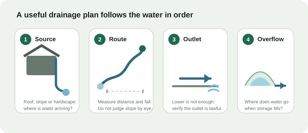
The planner deliberately keeps storm volume, property sketch, route distance, measured fall and field verification in one place. A proposed fix is more useful when the same sketch also shows what has not yet been verified.
What stays local
The core planner runs in your browser and stores its working state under wrivel-plan. The infiltration worksheet uses wrivel-infiltration-test, and the Storm Observation Log uses wrivel-storm-log. No account or property address is required. A copied share link deliberately places selected planner inputs in the URL; see Planner Data & Privacy for the exact behavior.
How calculations are treated
Wrivel labels planning assumptions rather than disguising them as universal design constants. Unit conversions are separated from scenario coefficients, and the Methodology page explains what each calculation does and does not represent. Technical context is linked on the Sources page, with a preference for government and standards-body material where practical.
What “interactive” should mean here
An interactive tool should change the answer when your measurements change. That is why the site uses focused calculators for runoff, grade, infiltration observations and storage instead of publishing dozens of near-duplicate articles with static numbers.
Editorial principles
How releases are checked
Wrivel uses automated production checks after publication for key pages, calculators, response headers and mobile browser behavior. The checks are intended to catch broken assets, calculation regressions and layout problems; they do not turn the site into a certified engineering service.
What Wrivel deliberately does not claim
Wrivel does not certify code compliance, flood-zone status, legal discharge rights, groundwater separation, pipe hydraulic capacity, structural safety, utility clearance or property boundaries. Those limits are described in the Safety disclaimer.
How to use the site efficiently
- Start with the pooling diagnostic if the cause is unclear.
- Use the property planner once you can identify a source and candidate outlet.
- Open only the focused calculator needed for the next unknown measurement.
- Use the storm observation log when repeated rain events are part of the diagnosis.
- Use the field checklist before excavation or a quote.